September 8th, 2009
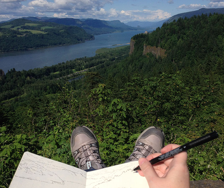
As I’ve mentioned before, I’m currently in the process of researching Mt. Rainier for my next artist book. This involves drawing and photographing the Mountain over and over (and over and over) again, in as many different conditions and from as many different vantage points as possible. I’ll get into the whys and hows some other time, but for now, suffice to say this is a huge challenge. Not only do we have incredibly unpredictable weather here, but Rainier also tends to play by his own rules, appearing and disappearing regardless of any logical connection to the forecast (which, somewhat ironically, is the entire point of my book…).
I’ve done my best to even the odds by doing the bulk of my research during the summer and early fall—traditionally the dry season here. This summer, however, has proven to be about as nontraditional as possible, and has thrown a whole lot of monkey wrenches into the works. For weeks I had planned a long trip to various points east, where the landscape is drastically different than here in the west. But here’s the rub: not only did I require a flawlessly sunny day to view the Mountain from so far away, but the best time to view Rainier from the east is in the morning—I’d have to leave too early to see that day’s weather report. So I waited, and stalked the National Weather Service, and packed and unpacked my gear. During our ridiculous heatwave we had day after day of beautiful sun, but hot weather makes the atmosphere so hazy that even from here, just forty miles away, Rainier was just a faint silhouette. And then it was one excuse after another; either I had an appointment or deadline I couldn’t change, or it was raining, or it was hot and hazy east of the Cascades, or there was a forest fire blocking my path (no joke!). Over a month went by like this, and I could feel my window of opportunity shrinking—many of the roads included in my plans are closed from October through June.
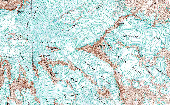
And then, a couple of weeks ago now, it seemed I’d finally get my chance. Every weather report promised dry, cool, sunny weather, for one lovely day, before the gloom closed in again. I packed my drawing paraphernalia, both cold and hot weather gear, a picnic lunch, a pile of atlases and topographic maps (you didn’t think I’d be using GPS, did you? When a letterpress printer marries a geologist, topo maps become a permanent fixture of both studio and science lab!), my camera, and plenty of music in the car, set the alarm for 3:15 am, and went to bed early with my fingers crossed.
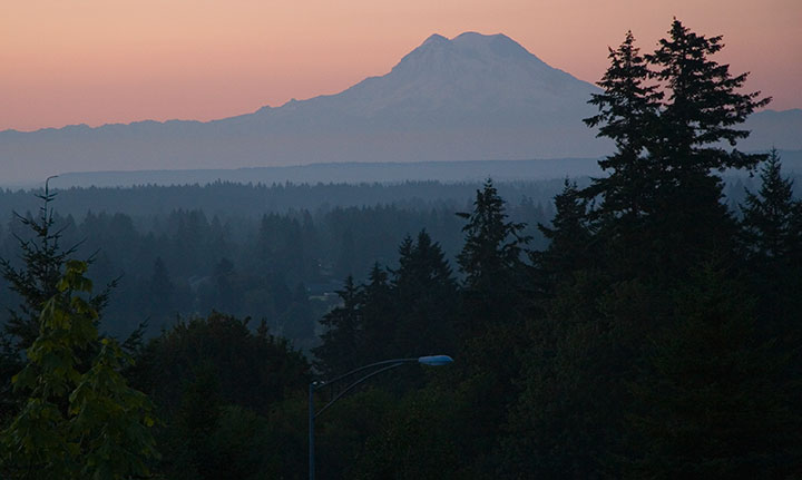
By 3:30 I was ready to go. I poked my head outdoors, saw stars overhead, and decided to make a break for it. Two hours later I arrived at my first stop: Tipsoo Lake, just off the road in an alpine meadow. To my immense surprise I wasn’t alone, even at that absurd pre-dawn, Wednesday hour, with the entire meadow blanketed with frost. A pair of photographers arrived just minutes after me and set up tripods nearby, and a friendly Slovak couple emerged from their tent to introduce themselves while we waited for the sun to rise. The biting cold made me question the sanity of this trip, but when the light finally spilled over the ridge to dye the Mountain pink, all my doubts disappeared.
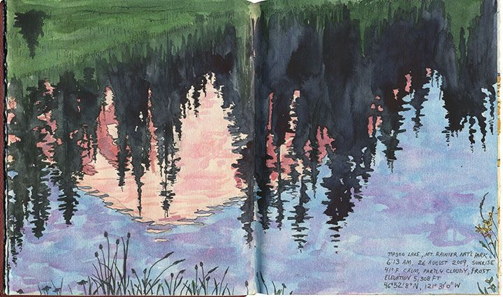
I stayed just long enough to block in a composition and shoot a few reference photos before the light changed and I lost the moment (I was on a tight timetable all day, so I finished all of these sketches back in the studio). I checked my watch and hit the road again (and waved to the Slovaks as I passed them again, thirty miles later).
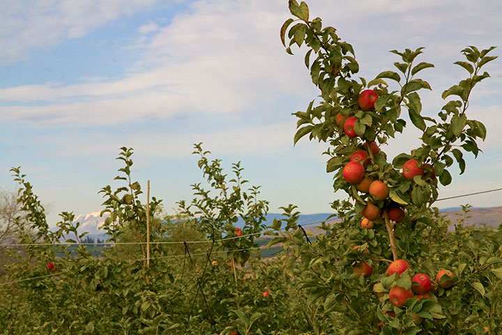
From here onward I had to work entirely on conjecture. Tipsoo Lake is a famous, oft-photographed spot, so I knew what sort of composition I wanted. But I had no photo reference for the rest of my guesses that day, only an idea of what I was looking for and a lot of half-memorized topographic maps. I was hoping to capture a scene of Rainier through the iconic apple orchards of Yakima, but I knew (from all the neck-craning I’ve done on previous drives through the region) that for the most part Rainier isn’t visible from the Yakima Valley, where most of the fruit trees are. According to my maps, though, there were some flat, gridded regions at the top of the bluffs overlooking Yakima—I hoped the grid meant farms, and that the extra 600 feet in elevation would be enough for a glimpse of the Mountain. So I made for Selah Heights Road—a hairline even on my most detailed map.
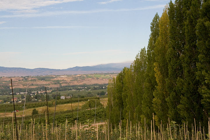
The road climbed past rows of poplars, trees laden with fruit and sweeping views of the valley; so far, so good.
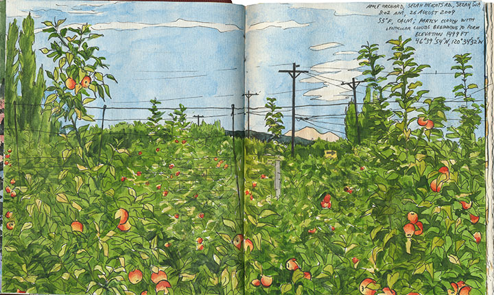
And then I found it: just the tip of Mt. Rainier visible between the apple trees. I couldn’t believe my luck. And just as I finished roughing out my drawing (I still had a lot of miles to cover before my next destination, so I worked fast and loose), I glanced to my left and discovered another treat:
Mt. Adams, for a little extra credit.
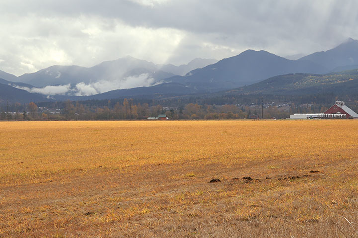
After a quick, desperate and delicious coffee in Yakima, I turned south. My next stop was a place I’d never been: the Centerville Valley, a high-plains agricultural area just beyond Goldendale.
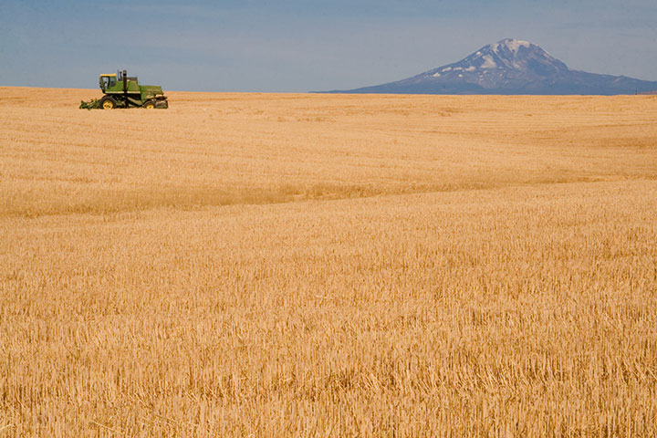
I knew that Adams would be prominently visible from here, but I could only hope that Rainier was as well—it sure would make a pretty picture if it were, I thought.
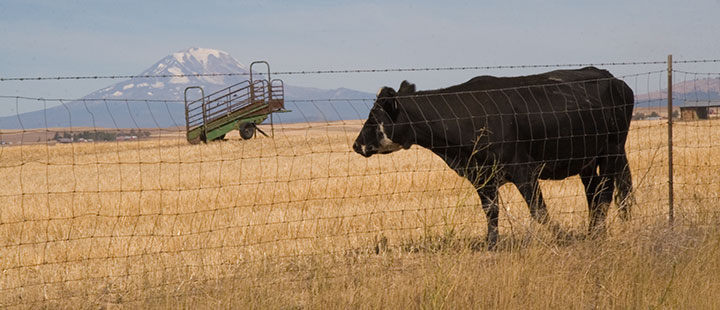
Nope, still Adams—although from this angle it tends to fool people (and cows).
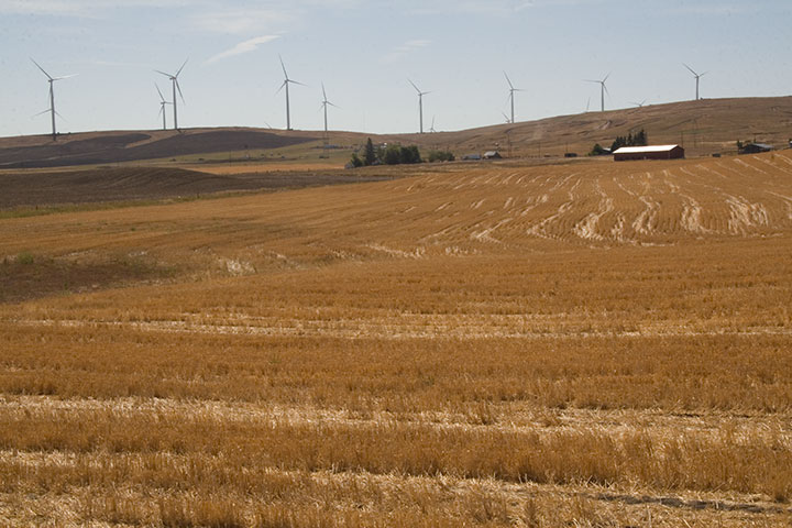
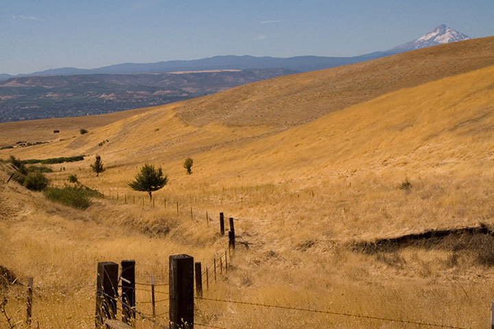
I looked behind me, and saw that the farmland sloped upward a bit, before giving way to the Columbia Hills. So I headed south along a dirt road for about a half mile, parked, and trudged a few yards into a field of wheat stubble.
Bingo.
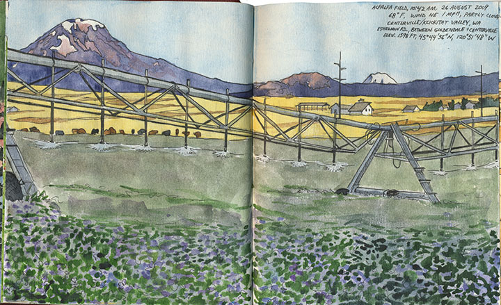
The alfalfa blossoms were sheer luck, just like so many other things that day. And that irrigation rig was moving—so I was never more thankful for digital photo technology than that moment (as a die-hard darkroom enthusiast, I never though I’d say that!).
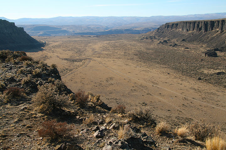
Only one item remained on the itinerary: a narrow, winding goat track called the Dalles Mountain Road.
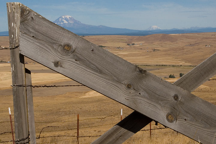
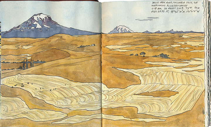
The spectacular vista of Adams, Rainier and the valley was just the beginning.
The road snakes over the top of the Columbia Hills, providing views of five volcanoes (that’s Hood there)…
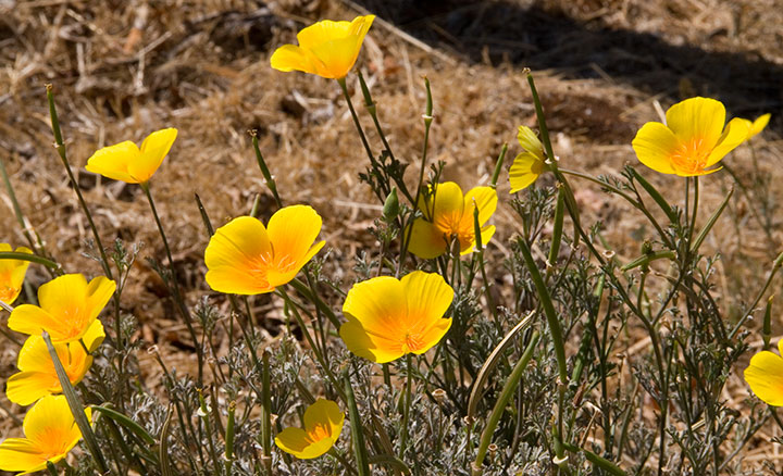
pockets of stunning wildflowers…
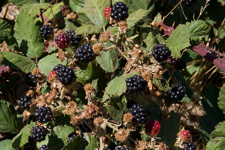
and plenty of road-side snacks.
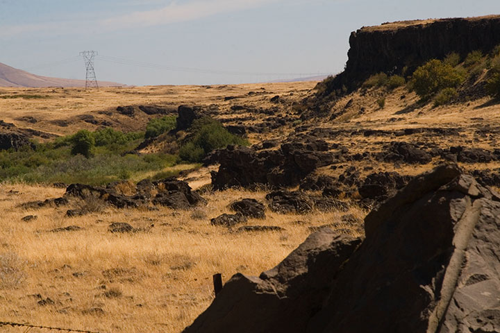
On the southern slope of the Hills the landscape turns suddenly rocky,
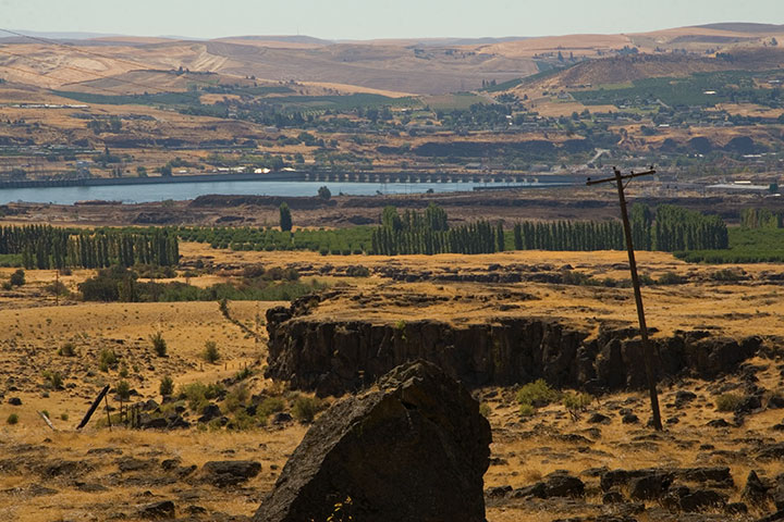
and the mighty Columbia River bursts into view.
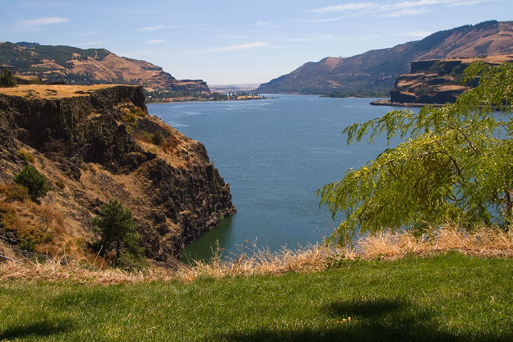
My research had gone off without a hitch, and right on schedule. It was only just noon: mission accomplished. So to celebrate I stopped for lunch at one of the most stunning picnic spots I’ve ever seen.
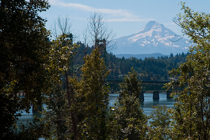
From that little patch of grass I could have chosen to go home the way I came, or finish the loop and return along the western side of the Cascades—it was almost perfectly equidistant. So as usual I chose the unknown road, and zipped home via the historic Columbia River Highway.
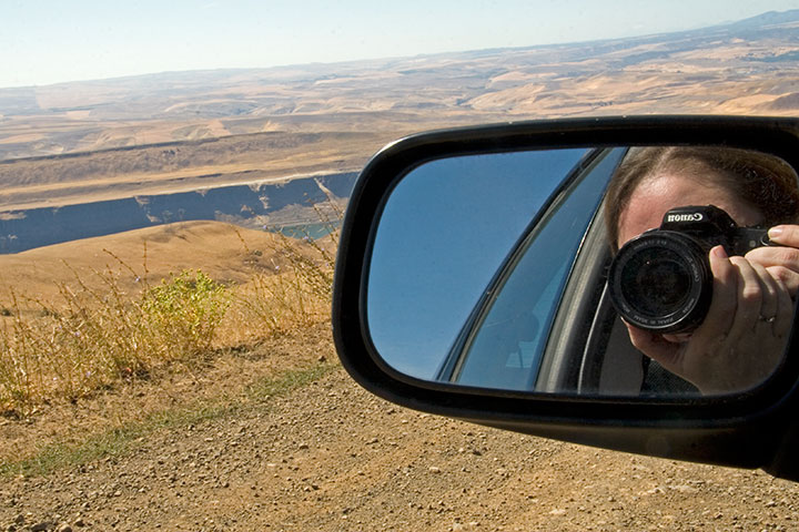
Fifteen hours, 515 miles roundtrip. And perfect conditions every step of the way. I think that after a summer of total frustration (remember the airplane incident?), maybe the universe decided to give me a break.
I’ll be sure to send a thank-you note.
August 6th, 2009
A year ago today our bright yellow moving truck pulled into Tacoma and turned the corner onto a new home, a new career, a new life. Here I am, 365 days later, and I’m still just as excited as on day one. To everyone in T-Town (and Seattle, and Portland, and everywhere in between!) who has welcomed me as one of your own: thank you, with everything I have.
I tend to be a list-maker, constantly looking ahead to what is yet to be done. And as I sifted through the thousands of photos I took over the past year, trying to narrow them down to a few favorites, a whole new to-do list emerged. Despite my best, most frantic efforts, I’ve barely scratched the surface of this new home of mine.
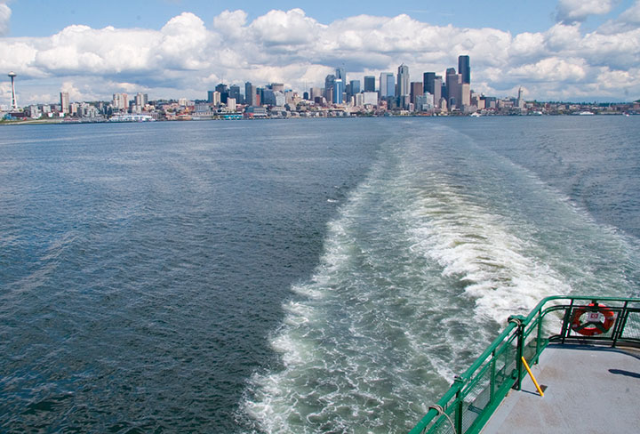
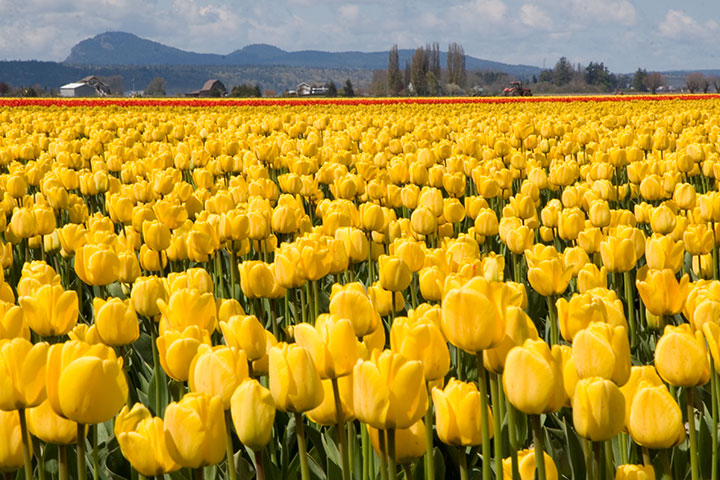
So I’ve got my work cut out for me. Washington, I’d like to get to know you a little better.