Blog
July 20th, 2011
As you may have already noticed, I kind of have a thing for lighthouses.
It’s probably no surprise they’ve cropped up in my work lately, since my corner of the world is fair teeming with them.

But I even find myself sneaking them into other projects, even when it’s not strictly necessary.
So you can imagine my excitement on my trip back East,
when there seemed to be a beacon
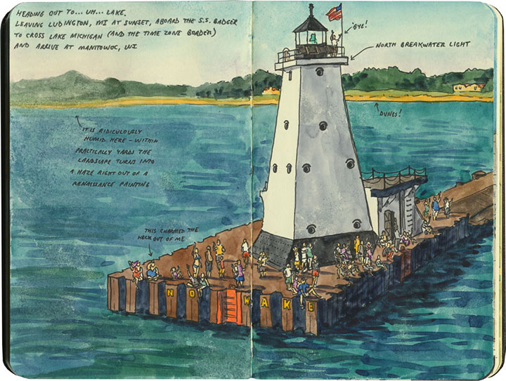
around every corner.
Best keep a sharp eye out—
I have a feeling there’ll be more lighthouses popping up here in future.
June 19th, 2011
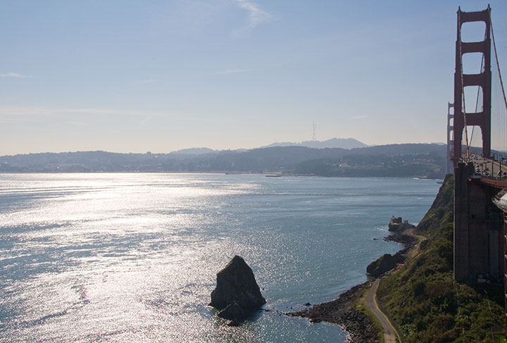
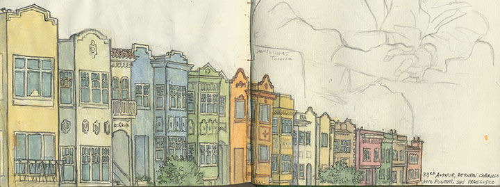
Even though my trip south originally brought me across the Bay, it seemed like San Francisco was the logical starting point for my long trek home along the coast.
So after a quick sketch (while humming that Journey song that popped into my head for the umpteenth time), I crossed the bridge and headed north.
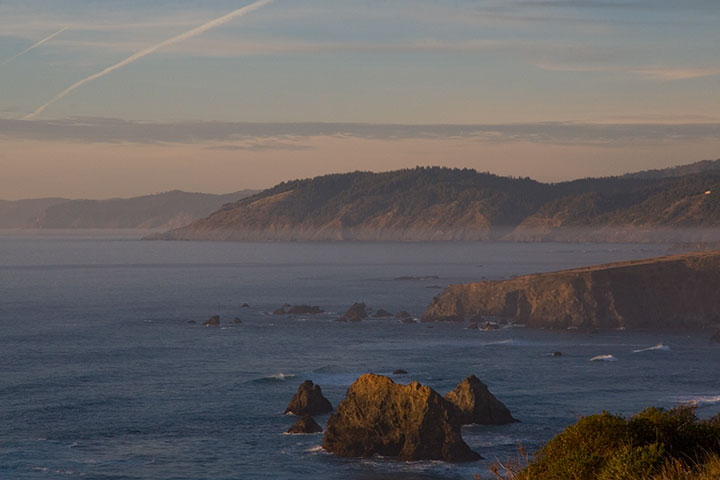
It wasn’t long before I’d left civilization almost completely behind. My chosen route was the (in)famous Highway One, which winds a precarious path along the shore, with breathtaking views and treacherous challenges at every hairpin turn. In other words, it was perfect in nearly every way. Despite the environmental guilt of it all, I confess that I love driving—and hugging the curves of 300 miles of switchbacks in a stick-shift Subaru? Pure, unadulterated bliss. And while I missed the company of the Tailor, or any of my other traditional travel buddies, it was nice to be able to stop and take a picture every thirty seconds, without the risk of annoying anyone!
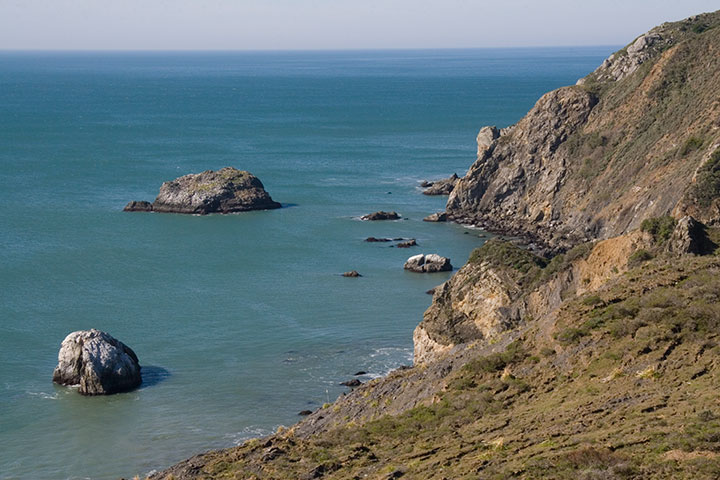
I knew that by traveling the Coast Highway on a weekday in February, I’d have the place pretty much to myself. But I was completely unprepared for the solitude that awaited me at my first stop along the way: Point Reyes National Seashore.
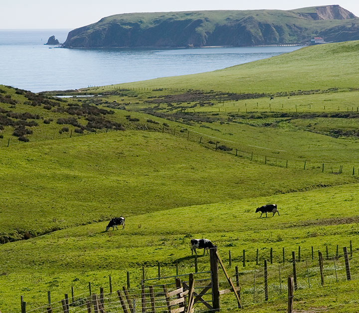
Point Reyes is a long, jagged cape with an equally long history. Sir Francis Drake reportedly landed there in 1579, and people have inhabited it, farmed it, settled it, and even wrecked their ships upon it for many, many generations. Since the 1850s much of the land has been parceled out into dairy farms, which are still in operation today, thanks to the protection of the National Park Service.
What first struck me about the place is the near total absence of trees. The place reminded me more of the Scottish highlands than anything I’d seen in California—and in fact, one of the few small towns located on the peninsula is called Inverness.
And I’m sure that at the height of summer, the place is crawling with tourists—but that day I was completely alone. For miles and miles and miles, it was just me and the cows.
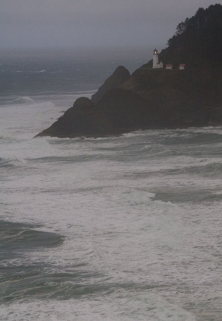
I hadn’t intended to travel the whole length of the cape; I wasn’t on a fixed timetable or anything, but by that point it was already late morning. But I saw a sign indicating a lighthouse ahead, so I kept going. There was no mile count on the sign, and I didn’t bother to fish out the map. It couldn’t be far, right? Well, the road wound on and on and on, with no sign of a lighthouse, and no indication of where this would end. But then, a full twenty miles on, the track came to an abrupt end. I got out of the car, faced back north, and nearly had to pick my jaw up off the ground.

The lighthouse was just a short hike from there:
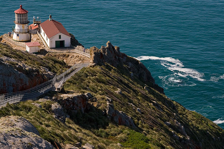
I could see why people were forever dashing their boats upon the rocks.
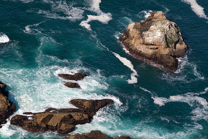
And that wasn’t the only thing I could see. I was staring into the bright teal surf when something surfaced and caught my eye:
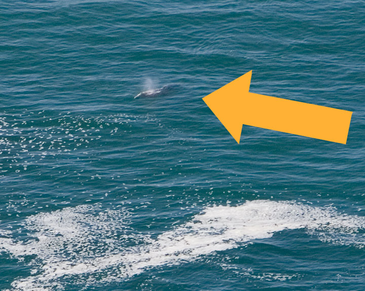
A gray whale! It’s funny—I’ve lived on one coast or another for over eleven years of my life, and I’d never seen a whale in person before. If that wasn’t worth the forty-mile detour, I don’t know what is.
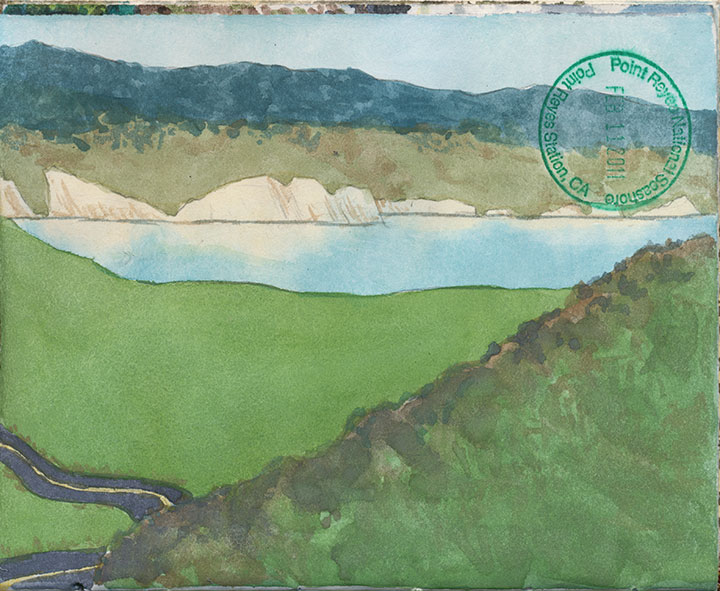
After the whale-watching and a 2-minute watercolor, I made the long trek back to the highway.
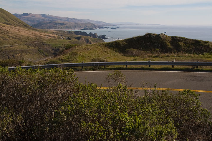
The remaining stretch of Highway One was almost equally deserted. It made the miles melt away quickly, and gave me the feeling that I had the whole Pacific to myself.
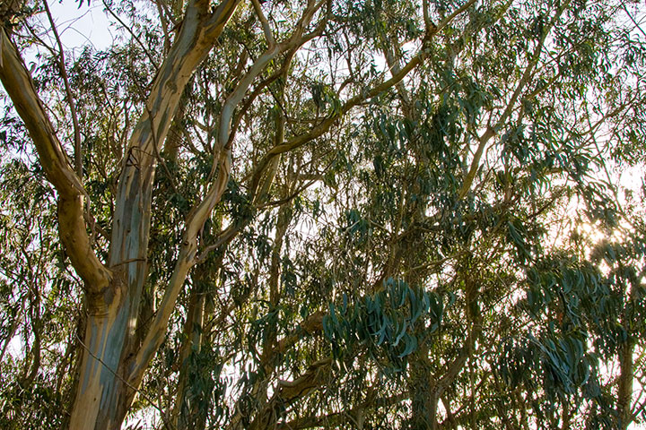
Before long, the rolling hills and eucalyptus trees tapered off,
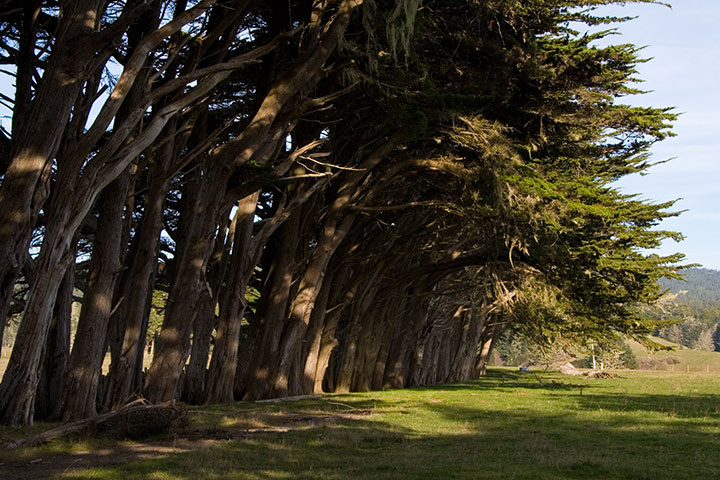
and the landscape gave way to cypress stands and evergreen forests.
The road ended just as the day did. As the sun went down the path turned eastward, away from the shore, and plunged into the thick darkness of coastal forest. By the time I pulled into a hotel for the night, it was pitch black, and Highway One had been replaced by the other Pacific Highway: US 101. I was in completely unfamiliar territory, and would be until I came all the way north to Astoria several days later, but despite the darkness and lack of bearings, I knew what lay ahead. And I was almost too excited to sleep, because I knew that in the morning, the sun would reveal exactly where I was: in the heart of redwood country.
March 16th, 2011
Not long ago I stood where the ripple of a far-away tragedy would soon wash ashore—just as we will send the Pacific rippling back westward when—not if—our time comes.
We received the echo of Japan’s catastrophe like the other end of a tin-can walkie-talkie, string pulled taut. This time the waves are faint at our end of the cable, but the distress call is loud and clear.
It’s a one-way game of telephone. Operator? There is no ripple to relay back along the string. No words of comfort to speak into the mouthpiece. So we send out a beacon instead—and hope the message reaches the far shore.
On our coast, and in our hearts, we’re leaving a light on for Japan.
May 9th, 2010
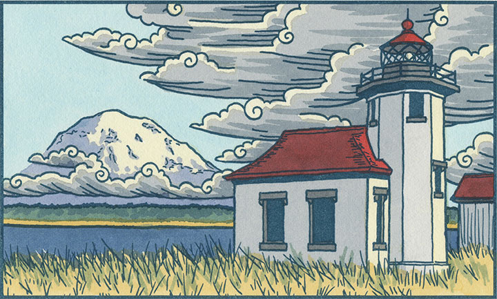
Today was just begging for a Sunday drive, Mother’s Day crowds be darned, so the Tailor and I moseyed up to another of my favorite haunts: Port Townsend.
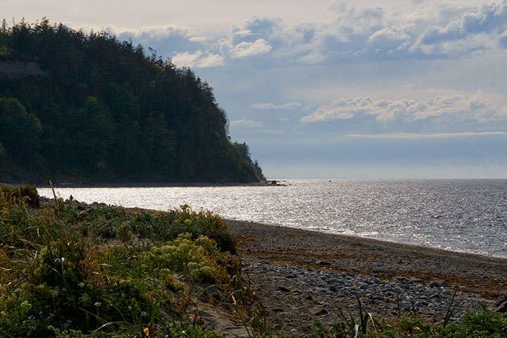
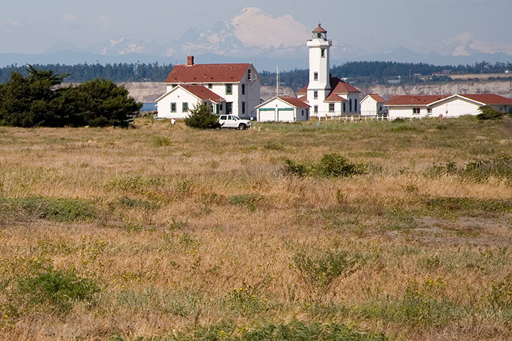
Port Townsend is located on the northeastern tip of the Olympic Peninsula (close on a map to but in reality very far from Cape Flattery) and guards Admiralty Inlet, where Puget Sound ends and the Straits of Juan de Fuca begin. It’s practically within shouting distance of Canada on one side (you can just make out the line of Vancouver Island along the horizon here), and lava-spewing range of Mt. Baker on another.
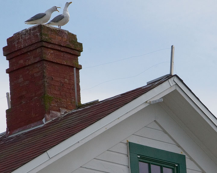
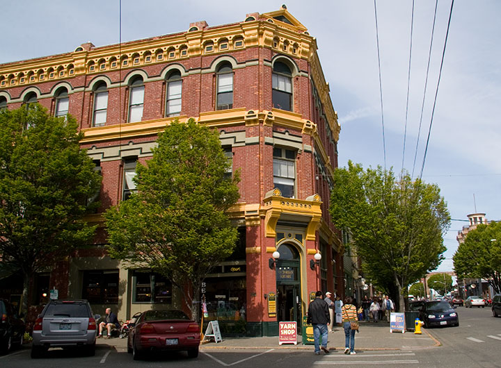
These days it’s a sleepy, semi-tourist town (thankfully it’s remote enough that it’s often possible to go without being mobbed by teeming hordes), home to both artists and seagulls, but at one time this place was hoppin’.
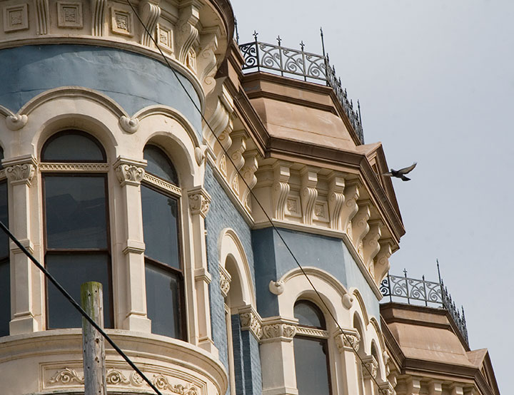
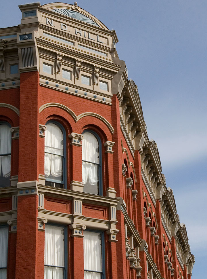
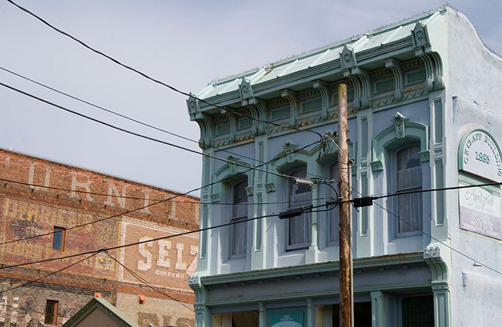
Its location made it an ideal military, trade, and shipping hub; Port Townsend was a prosperous and well-established seaport by the 1870s—nearly twenty years before Washington became a state. The town’s early boom afforded it a lavish and significant array of Victorian architecture—and once shipping fell out of favor there, its failure to develop a replacement industry (see above: remote) proved to be an accidental blessing of historical preservation. As a result, Port Townsend has an astonishing collection of Victorian houses and commercial buildings, and is one of only three seaports on the National Register of Historic Places.
Beyond the architecture (which, don’t get me wrong, is the stuff of my dreams), what I love about this place is how lived-in it feels. It’s not a stage set, or an overgrown museum, like so many historic towns I’ve seen. Port Townsend feels comfortable, inviting, and absolutely real.
It reminds me of places like Durango, Colorado; Stillwater, Minnesota; Salem, Massachusetts—all places that have taken up permanent residency in my heart. Places with real, breathing history and still-current ordinary life.
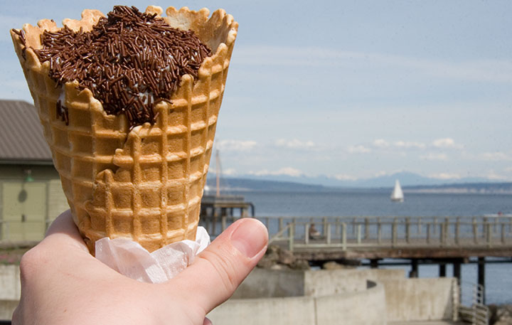
And I’m not even biased by the New England-authentic jimmies-coated ice cream cone I stumbled upon today—though the pitch-perfect nostalgia of my favorite childhood treat favorite-thing-in-the-whole-wide-world (which really can’t be found west of the Hudson, at least not completely slathered like this, and for which I nevertheless search tirelessly) made me happier than I can say.
Ahem. I digress. Big time. Port Townsend has one more beauty up its sleeve—although as it’s not on the beaten path, it’s easy to miss. The tippy-tip of the town’s little peninsula is occupied by Fort Worden, formerly an army installation (1890s to 1953) and now a state park. The gub’mint knew what it was doing with this one—they picked one of the loveliest and most strategically important chunks of real estate in the Pacific Northwest. I’m sure glad it belongs to all of us now—I think it’s better for flying kites than cannonballs anyway.
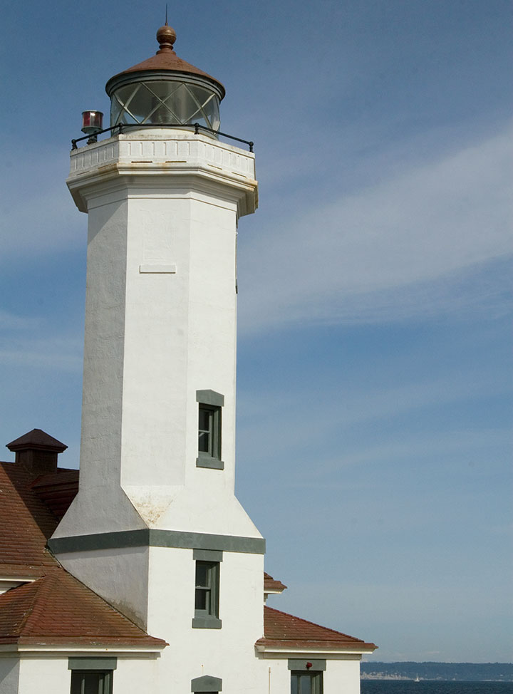
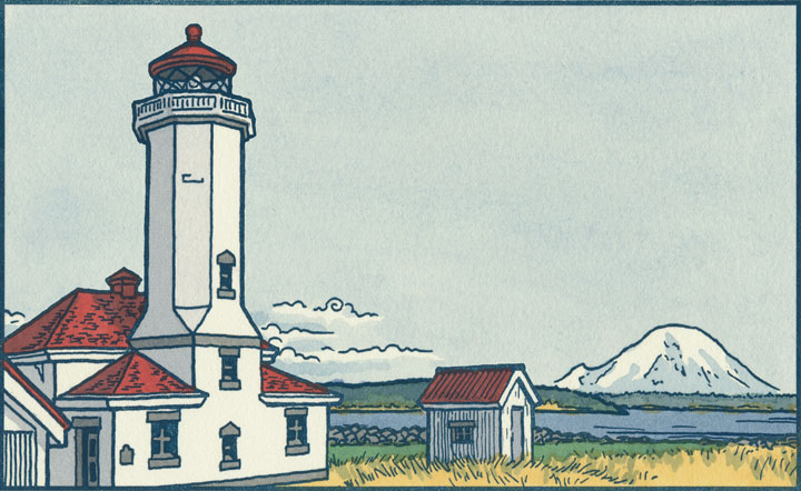
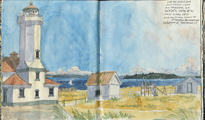
Fort Worden’s best feature, and the perfect climax to a day in Port Townsend, is Point Wilson Light, the tallest lighthouse on the Sound. This is one of my favorite spots to sit and watch the world go by, and today’s date reminded me that while we didn’t get to it on her recent visit, this is one spot that I think my mum would love, too.
Happy Mother’s Day, everyone! (And happy birthday, Dad!)